
Satellite Images Guide State Land Clearance in Beheira
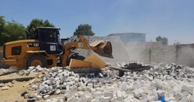
Egypt’s Beheira governorate has launched the 30th wave of a campaign to remove encroachments on agricultural land and state-owned property, using satellite imagery to support the effort.
The campaign is scheduled to continue until November 20 as part of the state’s plan to reclaim its land.
Satellite images are being used to help identify encroachments on state property and guide removal operations across the governorate.
The latest phase targets both the protection of farmland and the recovery of public land from unauthorized use, bringing the two priorities together in the ongoing clearance campaign.
This is an automated summary from the available headline and excerpt, not the full story or a claim of human review.
Latest Governorates — refreshed every 30 minutes
News refreshes automatically every 30 minutes. Every headline opens inside Trend Masr.